Atlas de Wit, 1698 : Stedenatlas van de Lage Landen : van Groningen tot Kamerijk. Atlas des villes des anciens Pays-Bas : de Groningue à Cambrai. Town atlas of the Low Countries : from Groningen to Cambrai
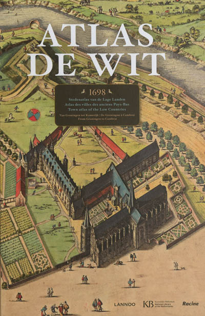
Atlas De Wit est un atlas historique unique du cartographe Frederick de Wit, qui contient 158 plans de ville, vues et estampes des anciens Pays-Bas du Nord et du Sud (les Pays-Bas, la Belgique et la Flandre française actuels).
Ce fac-similé à taille réelle contient de magnifiques cartes initialement coloriées à la main, dessinées en perspective. Les cartes donnent un point de vue vivant de l'histoire du 17<sup>e</sup> siècle, de Groningue à Cambrai.
L'introduction et les descriptions détaillées rendent cet atlas historique accessible à tous les amateurs d'histoire et de cartes anciennes.
Atlas De Wit is a unique, historical atlas by cartographer Frederick de Wit, containing 158 maps, views and prints of towns of the former Northern and Southern Netherlands (today's Netherlands, Belgium and French Flanders).
This full-size facsimile edition with its superb, originally hand-coloured maps, drawn in perspective, gives a lively view of 17th century city life from Groningen to Cambrai.
The introduction and the detailed descriptions of the individual maps make this historical atlas accessible to all lovers of history and old maps.
Atlas De Wit is een unieke, historische atlas van cartograaf Frederick de Wit met 158 stadsplatte-gronden, stadsgezichten en prenten uit de Noordelijke en Zuidelijke Nederlanden (het huidige Nederland, België en Frans-Vlaanderen).
Deze facsimile op ware grootte bevat prachtige, oorspronkelijk met de hand ingekleurde kaarten, in perspectief getekend. Ze geven een levendige kijk op de geschiedenis van de 17de eeuw, van Groningen tot Kamerijk.
De inleiding en de gedetailleerde kaartbeschrijvingen maken deze historische atlas toegankelijk voor alle liefhebbers van geschiedenis en oude kaarten.